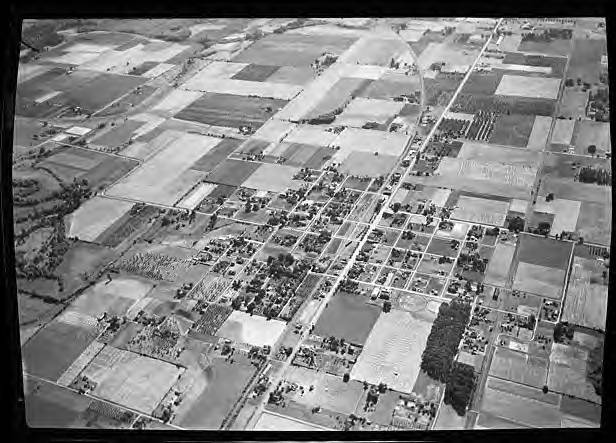
Aerial view of Cornelius
Title
Aerial view of Cornelius
Description
Black and white aerial image of Cornelius, Oregon. The main road running from the lower center left to the upper center right is Tualatin Valley Highway or Baseline Street, and the railroad runs along the south side of the road.
Date Created
circa 1938-1939
Subject
Aerial photographs
Aerial photography
Communities
Economic History
Urban Planning & Development
Place
Cornelius, Oregon
Medium
gelatin silver negatives
Identifier
WCMpic_015513
Rights
Online access to this image is for research and educational purposes only. To inquire about permissions, order a reproduction, or for more information, please contact the Five Oaks Museum at Research@FiveOaksMuseum.org.
http://rightsstatements.org/vocab/CNE/1.0/
Source
Robert L. Benson Research Library, Five Oaks Museum
Type
Still Image

